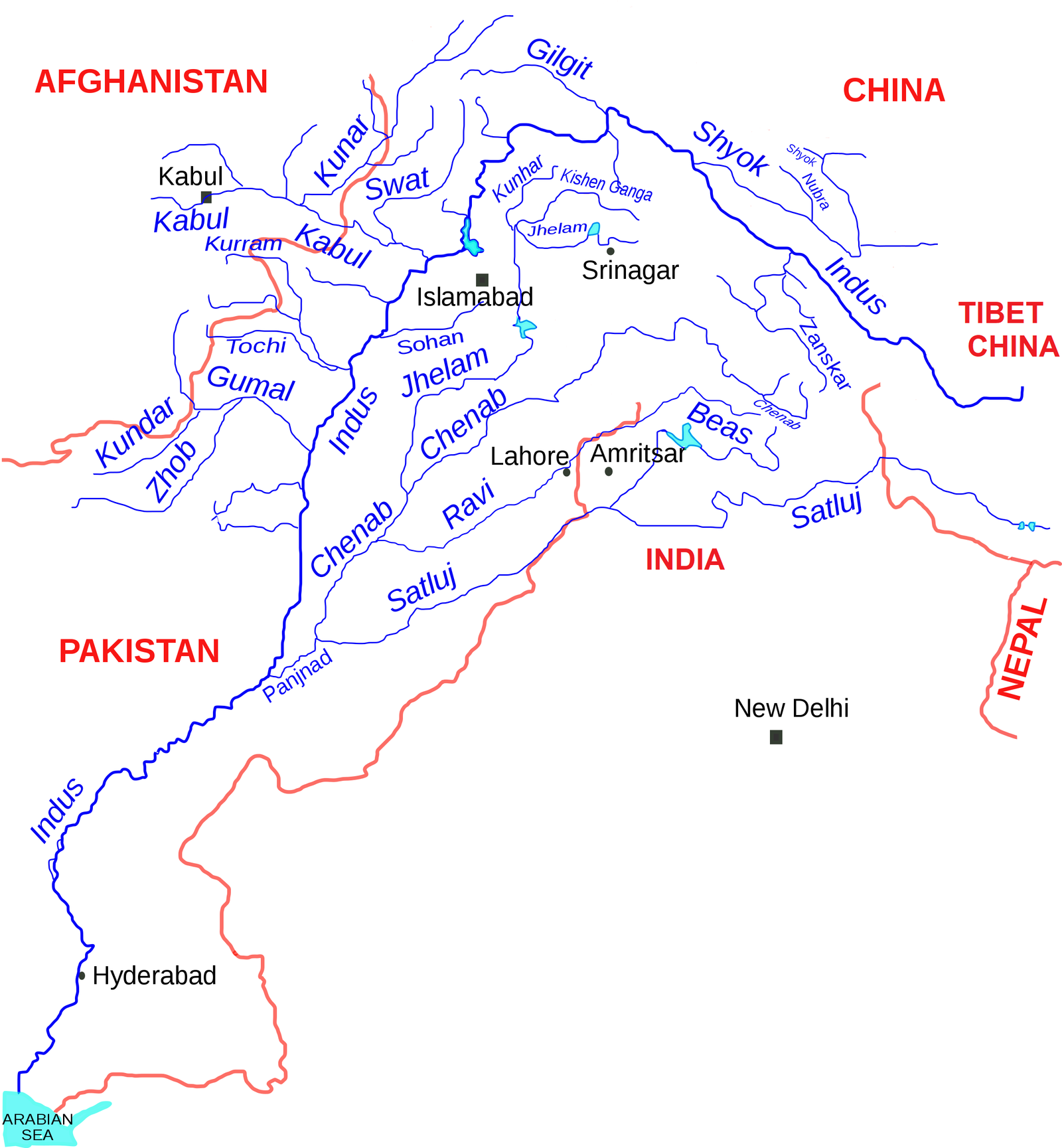
Flowing through the scenic states of Himachal Pradesh and Punjab, the Beas River is the smallest of the five major rivers in the Punjab region. Originating from the Himalayas in central Himachal Pradesh, this 470 km (290 miles) long river eventually merges with the Sutlej River in Punjab.
Covering a vast drainage basin of 20,303 sq. km, the Beas supports agriculture, livelihoods, and biodiversity. Notably, it is home to the endangered Indus dolphin, making it an ecologically significant river. Explore the history, geography, and ecological importance of the Beas River in this detailed guide!
✅ Explore the Complete List of Indian Geography Topics
Beas River System in a Nutshell
| Feature | Details |
|---|---|
| Name | Beas River (Vyas River) |
| Location | Himachal Pradesh, Punjab, India |
| Source | Beas Kund |
| Source Location | Himalayas, Himachal Pradesh |
| Mouth | Sutlej River |
| Mouth Location | Harike, Harike Wetland, Tarn Taran district, Punjab |
| Length | 470 km (290 mi) |
| Basin Size | 20,303 km² (7,839 sq mi) |
| Average Discharge | 499.2 m³/s (17,630 cu ft/s) |
| Discharge Location | Mandi Plain |
Ancient and Modern Names
- In the Rigveda, the Beas River was called Vipāś, meaning “unfettered.”
- In later Sanskrit texts, it was referred to as Vipāśā (विपाशा), and Yāska identified it as Argrikiya.
- Legends connect the river to Veda Vyasa, the author of the Mahabharata, who is said to have created it from its source, the Beas Kund.
- Another legend says that before Veda Vyasa, the river was called Saraswati.
- Rishi Vashishta, attempting to sacrifice his life by jumping into the river, was saved when the river turned into a sandbed and broke the cords binding him.
- Due to this, the river was named Vipasa, meaning “cord-breaker.”
- Rishi Vashishta later settled near the river, and the area became known as Vashisht, where the Vashishta Brahmarishi Temple is located today.
- The Ancient Greeks called the river Hyphasis (Ύφασης), while Pliny referred to it as Hypasis, derived from the Vedic name Vipāś.
- Other classical names include Hynais, Bipasis, and Bibasis.
- In modern times, the river is also known as Bias or Bejah.
Historical Significance
- The Beas River marked the easternmost boundary of Alexander the Great’s conquest in 326 BC.
- His troops refused to advance further, leading Alexander to halt his expedition.
- Alexander built twelve colossal altars to commemorate the end of his journey.
Historical References to the Beas River
- The Gurjara-Pratihara King Mahipala I’s territory extended to the Beas River, as noted in Kavyamimansa.
The Beas Project and Hydroelectric Development
- The Beas Project was initiated in the 20th century for irrigation and power generation.
- The Pong Dam (1974) was built for irrigation and later upgraded for 396 MW of power generation.
- The Pandoh Dam (1977) diverts Beas water to the Dehar Power Station (990 MW) on the Sutlej River.
Canals and Power Generation
- The Shahnehar Canal uses water from the Pong Dam for irrigation and powers the Mukerian hydel station (207 MW).
- At the Beas-Sutlej confluence, the Harike Barrage diverts combined river water for irrigation in Rajasthan and Punjab.

The Course of the Beas River
- The Beas River originates at 4,361 meters (14,308 ft) above sea level on the southern face of Rohtang Pass in Kullu, Himachal Pradesh.
- It flows through the Mandi District and enters the Kangra District at Sandhol, at 590 meters (1,940 ft) above sea level.
- Near Reh in Kangra District, it divides into three channels, reuniting after passing Mirthal, at 300 meters (980 ft) above sea level.
- On meeting the Sivalik Hills in Hoshiarpur, the river sharply turns northward, forming a boundary with Kangra District.
- It bends around the base of the Sivalik Hills, flowing southward, separating the Gurdaspur and Hoshiarpur districts.
- The Beas touches the Jalandhar District, forming boundaries between Amritsar and Kapurthala before joining the Sutlej River in Punjab.
Key Features
- Length: 470 kilometers (290 miles).
- Tributaries: Bain, Banganga, Luni, and Uhal.
- The Beas water is allocated to India under the Indus Waters Treaty with Pakistan.
- The mean annual flow of the river is 14.203 million acre-feet (MAF).
Connection with Other Rivers
- The Panjnad River further joins the Indus River at Mithankot.
- After joining the Sutlej River, the flow continues into Pakistani Punjab and merges with the Chenab River at Uch near Bahawalpur, forming the Panjnad River.
FAQs
The Beas River originates from Beas Kund, located in the Himalayas in Himachal Pradesh, India.
The Beas River flows through the states of Himachal Pradesh and Punjab in India.
The Beas River originates from the state of Himachal Pradesh.
The Beas River starts at Beas Kund in the Himachal Pradesh state and flows through Punjab, ultimately joining the Sutlej River at the southwestern boundary of Kapurthala district in Punjab.
Yes, there are several dams on the Beas River: Pong Dam (also known as Maharana Pratap Sagar Dam) located in Kangra District, Himachal Pradesh.
Pandoh Dam is located in Mandi District, Himachal Pradesh.
Additionally, there are hydroelectric power stations like Dehar Power Station and Mukerian Hydel Power Station that utilize the river for power generation.
The Beas River was historically known as Vipāś in the Rigveda. It has also been referred to as Vipāśā in later Sanskrit texts.
The Beas River is also known as Vipasa, a name that reflects its ancient significance, meaning “unfettered” or “cord-breaker” in Sanskrit, referencing its unrestrained flow and its mythological connections.
