In this article, we have compiled a list of 9 neighbouring countries of India, their capitals, the length of their international borders with India, and some relevant facts. India’s neighbouring countries include China, Nepal, Bhutan, Pakistan, Myanmar, Sri Lanka, Bangladesh, Maldives, and Afghanistan. This detail is valuable for those preparing for upcoming competitive exams such as SSC MTS, SSC CGL, RRB NTPC, and other state-level exams. In addition to the names of the countries, it would also be helpful to know their respective capital cities.
✅ Explore the Complete List of Indian Geography Topics
Neighbouring Countries of India Short guide
▪ India, the most populous country in the world, is located near the Arabian Sea and the Bay of Bengal.
▪ The total length of India’s land border is 15,106.7 km, and its coastline stretches for 7,516.6 km.
▪ It shares borders with China, Nepal, Bhutan, Pakistan, Myanmar, Sri Lanka, Bangladesh, Maldives, and Afghanistan.
▪ Notably, Myanmar, Maldives, and Sri Lanka have coastal borders with India.
▪ The Union Territory of Ladakh, in particular, shares international borders with 3 countries: China, Pakistan, and Afghanistan.
▪ India’s international borders are among the largest in the world, following only China and Russia.
▪ However, they also present significant vulnerabilities, including extreme weather conditions and the potential for infiltration.
Neighbouring Countries of India: Quick Overview
| Exams Covered | All exams |
| Topic Category | Static Gk |
| Total Neighbouring Countries Of India | 9 |
| Neighbouring Countries Of India | Afghanisthan, Pakistan, China, Nepal, Bhutan, Bangladesh, Sri Lanka, Maldives and Myanmar |
| Total Length of the Land Border Of India | 15,106.7 k.m. |
| Total Length Of Indian Coastline | 7516.6 km |
List of Neighbouring countries of India & their capitals
▪ Here is the list of neighbouring countries bordering India with capitals.
| Sl. No | Neighboring Country | Capital | Length of Border |
|---|---|---|---|
| 1 | Afghanistan | Kabul | 106 km |
| 2 | Bhutan | Thimphu | 578 km |
| 3 | Bangladesh | Dhaka | 4096 km |
| 4 | China | Beijing | 3488 km |
| 5 | Myanmar | Naypyidaw | 1643 km |
| 6 | Nepal | Kathmandu | 1752 km |
| 7 | Pakistan | Islamabad | 3310 km |
| 8 | Sri Lanka | Sri Jayawardenepura Kotte (Legislative Capital) Columbo (Executive Capital) |
Separated by the Gulf Mannar |
Neighbouring countries of India map
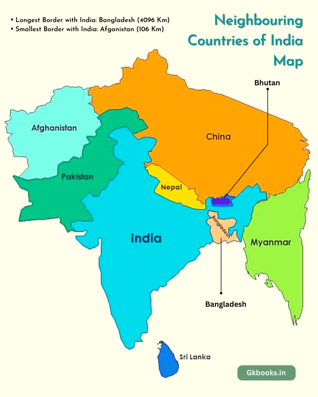
India’s Neighbouring Countries with Highest Peaks & Border States
| Sl. No | Neighboring Country | Highest Peak | Border States |
|---|---|---|---|
| 1 | Afghanistan | Mount Noshaq | Ladakh |
| 2 | Bhutan | Gangkhar Puensum | West Bengal, Sikkim, Arunachal Pradesh & Assam |
| 3 | Bangladesh | Keokradong | West Bengal, Meghalaya, Mizoram, Tripura and Assam |
| 4 | China | Mount Gongga | Ladakh, Himachal Pradesh, Uttarakhand, Sikkim and Arunachal Pradesh |
| 5 | Myanmar | Mount Hkakabo | Arunachal Pradesh, Nagaland, Mizoram and Manipur |
| 6 | Nepal | Mount Everest | Bihar, Uttarakhand, Uttar Pradesh, Sikkim and West Bengal |
| 7 | Pakistan | K2 | Jammu and Kashmir, Ladakh, Punjab, Rajasthan and Gujarat |
| 8 | Sri Lanka | Pidurutalagala | Separated by the Gulf Mannar |
| 9 | Maldives | Mount Villingili | Marie time Border, Nearest UT Lakshadweep Island |
Flags of neighbouring countries of India
| Sl. No | Neighboring Country | Flags |
|---|---|---|
| 1 | Afghanistan |  |
| 2 | Bhutan | 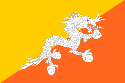 |
| 3 | Bangladesh |  |
| 4 | China | 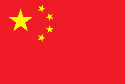 |
| 5 | Myanmar | 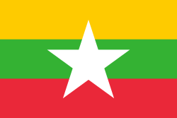 |
| 6 | Nepal |  |
| 7 | Pakistan | 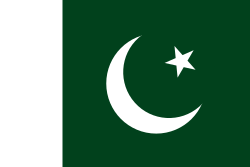 |
| 8 | Sri Lanka |  |
| 9 | Maldives |  |
Currency of Neighbouring Countries of India
| Sl. No | Neighboring Country | Currency | Currency Code |
|---|---|---|---|
| 1 | Afghanistan | Afghan Afghani (AFN) | AFN |
| 2 | Bhutan | Bhutanese Ngultrum | BTN |
| 3 | Bangladesh | Bangladeshi Taka | BDT |
| 4 | China | Chinese Yuan / People’s renminbi | CNY/ RMB |
| 5 | Myanmar | Myanmar Kyat | MMK |
| 6 | Nepal | Nepalese Rupee | NPR |
| 7 | Pakistan | Pakistani Rupee | PKR |
| 8 | Sri Lanka | Sri Lankan Rupee | LKR |
| 9 | Maldives | Rufiyaa | MVR |
Neighbouring Countries of India and their Languages
| Sl. No | Neighboring Country | Official Language | Other Language |
|---|---|---|---|
| 1 | Afghanistan | Dari , Pashto | Uzbek, Turkmen, Urdu, Pashayi, Nuristani, Arabic, and Balochi |
| 2 | Bhutan | Dzongkha | Tshangla (Sharchop), Nepali, Dzala, Kheng and, Bantawa |
| 3 | Bangladesh | Bengali | Chakma, Urdu, Garo, Meitei, Kokborok |
| 4 | China | Mandarin | Cantonese (Yue), Gan, Hakka, Min, Wu (Shanghainese),Xiang (Hunanese) |
| 5 | Myanmar | Burmese | Karen, Kachin, Chin, Shan |
| 6 | Nepal | Nepali | Maithali, Tharu, Newar |
| 7 | Pakistan | Urdu, English | Punjabi, Pashto, Sindhi, Saraiki, Balochi |
| 8 | Sri Lanka | Sinhala and Tamil | Veddah, Sri Lankan Malay |
| 9 | Maldives | Dhivehi | Sinhalese, Gujarati, Malayalam |
Neighboring Countries of India: Summary
Afghanistan
▸ Border length – 106 km
▸ Border UTs – Ladakh
▸ Capital – Kabul
▸ Currency – Afghan Afghani
▸ Official language – Dari and Pashto
▸ A landlocked country in Central and South Asia.
▸ Referred to as the Heart of Asia.
▸ Largest city – Kabul
▸ National symbols of Afghanistan
- National animal – Snow leopard
- National bird – Golden eagle
- National dog – Afghan Hound
- National tree – Afghan pine
- National fruit – Pomegranate
- National sport – Buzkash
- National dish – Kabuli palaw
Bhutan
▸ Border length – 578 km
▸ Border States – Sikkim, Assam, Arunachal Pradesh, and West Bengal.
▸ Capital – Thimphu
▸ Official language – Dzongkha
▸ Official currency – Bhutanese Ngultrum
▸National symbols of Bhutan
- National animal – Takin
- National bird – Raven
- National tree – Himalayan cypress
- National flower – Himalayan blue poppy
- National Sport – Archery
Bangladesh
▸ Border length – 4096 km
▸ Capital – Dhaka
▸ Border States – Assam, Meghalaya, Tripura, Mizoram, and West Benga.
▸ Official language – Bengali
▸National symbols of Bangladesh
- National flower – Water lily
- National fruit – Jackfruit
- National animal – Royal Bengal Tiger
- National fish – Illish
- National bird – Magpie robin
China
▸ Border length – 3488 km
▸ Border States / UTs – Ladakh, Himachal Pradesh, Uttarakhand, Sikkim, Arunachal Pradesh.
▸ Capital – Beijing
▸ Official language – Mandarin
▸ Currency – Renminbi
▸ World’s Second most populous country. (1.4 billion people)
▸ China spans five geographical time zones.
▸ Share its land borders with fourteen countries.
• Both Russia and China share their land borders with 14 countries. (most of any country in the world)
▸National symbols of China
- National animal – Chinese dragon
- National bird – Red-crowned crane
- National fruit – Fuzzy kiwifruit & Jujube
- National tree – Ginkgo (Ginkgo biloba)
- National flower – Plum blossom
- National Instrument – Guqin
- National Sport – Table tennis
- National Dish – Peking duck
- National Drink – Baijiu
Myanmar
▸ Border length – 1643 km
▸ Border State – Arunachal Pradesh, Nagaland, Mizoram, and Manipur
▸ Capital – Naypyidaw
▸ Official language – Burmese
▸ Currency – Myanmar Kyat
▸ Formerly known as Burma
▸ Largest country in Mainland Southeast Asia.
▸ largest city – Yangon (Rangoon)
▸ National symbols of Nepal
- National Animal – Tiger
- National Game – Chinlone (Caneball)
- National Bird – Grey Peacock-Pheasant
- National Fruit – Padauk
- National Tree – Green Peafowl
Nepal
▸ Border length – 1752 km
▸ Border State – Arunachal Pradesh, Nagaland, Mizoram, and Manipur
▸ Capital – Kathmandu
▸ Currency – Nepalese rupee
▸ Official language – Burmese
▸ Upper house – National Assembly
▸ Lower house – House of Representatives
▸ Nepal is a landlocked country in South Asia.
▸ National symbols of Nepal
- National animal – Cow
- National Tree – Peepal
- National flower – Rhododendron arboreum
- National weapon – Khukuri
- National dance – Newa dance
- National instrument – Madal
- National dish – Dal Bhat (NEPAL)
- National sport – Volleyball (NEPAL)
Pakistan
▸ Border length – 3310 km
▸ Border State/UTs – Jammu, Kashmir, Ladakh, Punjab, Gujarat, and Rajasthan.
▸ Official language – Urdu
▸ Largest city – Karachi
▸ Capital – Islamabad
▸ Currency – Pakistani rupee
▸ Upper house – Senate
▸ Lower house – National Assembly
▸ World’s 5th most populous country.
▸ World’s 2nd largest Muslim population country.
▸ National symbols of Pakistan
- National flower – Common jasmine
- National tree – Himalayan cedar (Deodar)
- National fruit – Mango
- National vegetable – Lady Finger
- National animal – Markhor
- National aquatic marine mammal – Indus river dolphin
- National predator – Snow leopard
- National bird – Chukar partridge
- National fish – Mahseer (Himalayan golden mahseer)
- National reptile – Indus Crocodile
Sri Lanka
• Border length – separated by the Gulf of Mannar
• Border State – Separated by the Gulf of Mannar (Nearest State: Tamil Nadu)
• Official language – Sinhala and Tamil
• Currency – Sri Lankan rupee
• Capital – Sri Jayawardenepura Kotte (legislative) & Colombo (executive and judicial)
• Formerly known as Ceylon.
• Largest city – Colombo
▸National symbols of Sri Lanka
- National flower – Water lily flower (Nymphaeaceae)
- National tree – Ceylon ironwood (Mesua ferrea)
- National bird – Sri Lankan junglefowl (Gallus lafayette)
- National butterfly – Sri Lankan birdwing (Troides darsius)
- National gemstone – Blue sapphire
- National sport – Volleyball
Neighbouring Countries of India Video
Frequently Asked Questions (FAQ)
Answer: 9
☛ Afghanistan, Bhutan, Bangladesh, Maldives, China, Myanmar, Nepal, Pakistan, and Sri Lanka are the countries bordering India.
Answer: Bangladesh (4096 Km)
Answer: India’s landlocked neighbours are Nepal, Bhutan, and Afghanistan.
Answer: Sri Lanka, Maldives
Answer: Bhutan
DOWNLOAD PDF HERE [Neighbouring Countries of India]

